Pelican - Packbot
Collaborative Mapping of an Earthquake Damaged Building via Ground and Aerial Robots
 We design a system to conduct field experiments with a team of ground and aerial robots toward the collaborative mapping of an earthquake damaged building. The goal of the experimental exercise is the generation of 3D maps that capture the layout of the environment and provide insight to the degree of damage inside the building. The experiments were to take place in the top three floors of a structurally compromised engineering building at Tohoku University in Sendai, Japan that was damaged during the 2011 Tohoku earthquake. We provided details of the approach to the collaborative mapping and report results from the experiments in the form of maps generated by the individual robots and as a team.
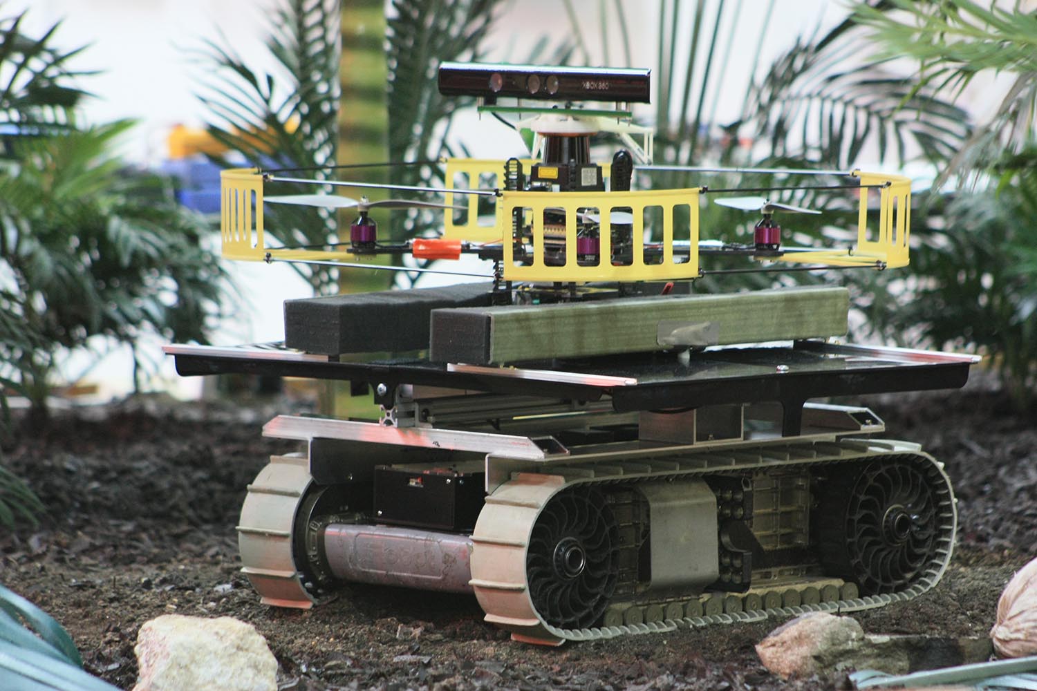
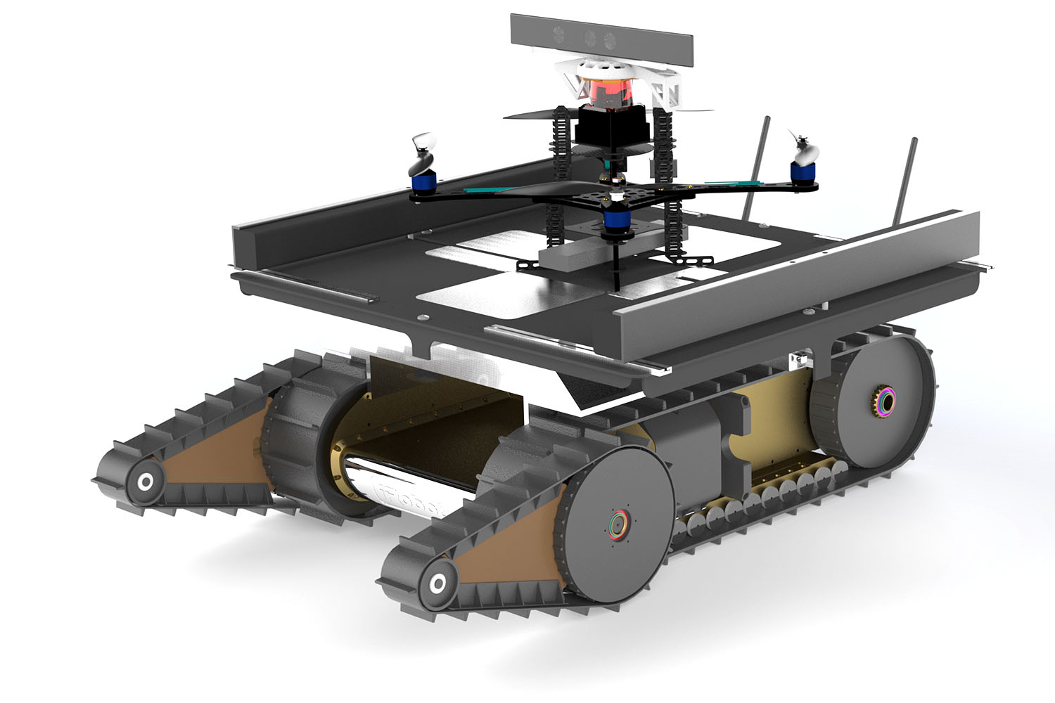
Physical test vehicle
Tech Specs
| Compute |
|
|---|---|
| Sensors |
|
| Communication Link | 2.4GHz 802.11n WiFi |
| Propulsion System |
|
| Power |
|
| Dimensions | Mark |
| All up Weight | 1100g |